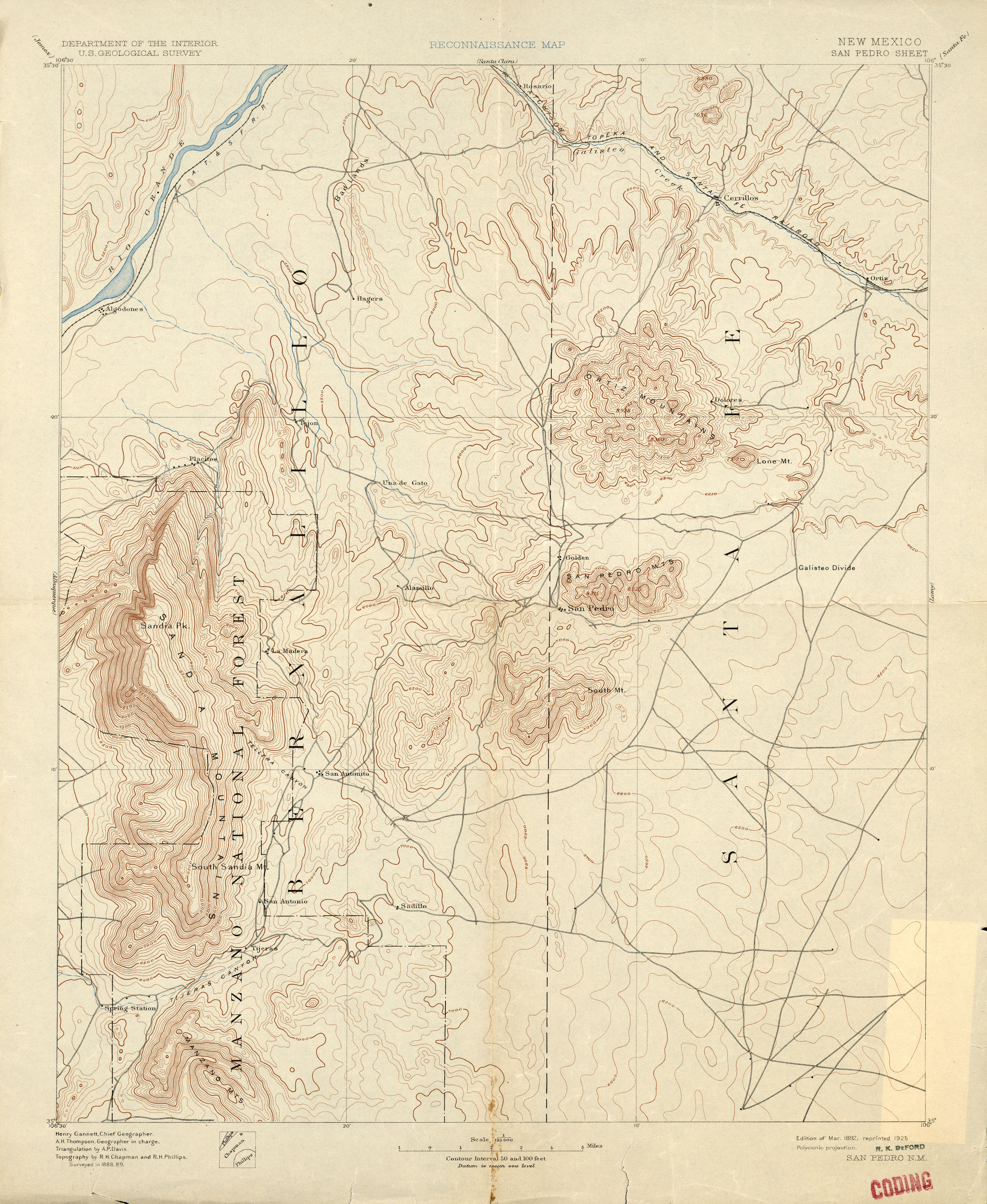
I've spotted that alignment too - it's an old old road that used to go all the way around from Placitas thru La Madera to Tijeras.    Can see in on this map, originally published in 1892 and reprinted in 1925:

https://maps.lib.utexas.edu/maps/topo/new_mexico/txu-pclmaps-topo-nm-san_pedro-1889.jpg

The current Tecolote street in Placitas is on that old alignment.    I've looked for and spotted the segment your map shows; intersection with public road is now on a private lot; and behind (east) of that lot it enters the town of Tejon grant which the Diamond Tail Ranch seems to control access to now.   I've poked around the SE access too - there is a road from 14 thru town of Puertocito, past ghost town of Tejon (on the old map) to the Black Mesa Casino I'd driven a few years ago.  Blocked, last time I looked, by Diamond Tail gate west of Puertocito, about where public road drops north off Golden Open Spaces and connects with Puertocito road.

Neil McC

On Sun, Jan 30, 2022 at 12:06 PM John Vance via Bike-racers <bike-racers@mailman.swcp.com> wrote:
Looks like access to it is blocked by private property, and if there was a viable path to the east of the properties involved, it's eroded in the past 15 years.

On Sun, Jan 30, 2022 at 11:39 AM John Vance <adogapanicinapagoda@gmail.com> wrote:
I've been playing with Strava's auto route creation, and it keeps using this track from OpenStreetMap.  Does anyone know anything about it?  Have you ridden it?  Are there legal restrictions against using it?  Is it passable by bike?  Looking at satellite view it definitely looks sketch but there are double tracks all along its length.

Here's the track:

_______________________________________________
Bike-racers mailing list
Bike-racers@mailman.swcp.com
https://mailman.swcp.com/cgi-bin/mailman/listinfo/bike-racers